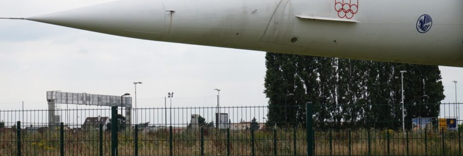
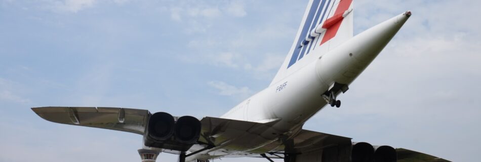
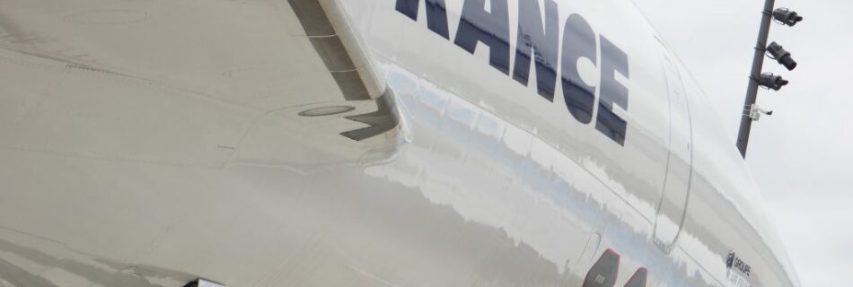
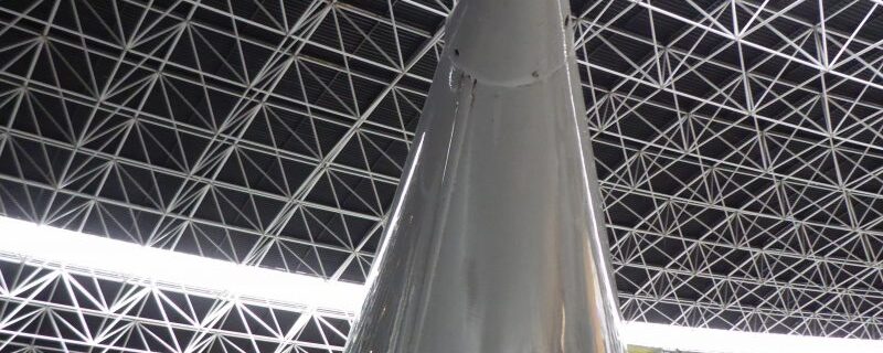
Categories
Blog Concorde

Concorde 202 G-BBDG, Weybridge, England.

My local Concorde I suppose, although the Concorde at Heathrow G-BOAB is actually closer (more of the scandal of Alpha Bravo later!).

Delta Golf is perhaps the most accessible Concorde for people living in London and I think the one of the best presented. For £5 on top of the Brooklands Museum admission you can take the ‘Concorde Experience” which includes a guided tour of the Aircraft and a great AV presentation onboard in the front cabin… It’s as close as anyone is going to get to flying in Concorde today anyway.

My son joins me at Brooklands, don't worry he never smiles !
My son joins me at Brooklands, don’t worry he never smiles !

Delta Golf had a brief, if interesting life, the British development airframe which achieved the type certification and unlike modern development aircraft never entered airline service. Flying for the first time in 1974 and retiring from flight in 1981 after only 1282 hours, it then became a source of spares for the British Airways fleet stored at Filton. In 2004 Delta Golf was acquired by Brooklands and finally put on display in 2006.

Of course it would be amiss not to mention the urban myth that Delta Golf was used by the Ministry of Defence to test UK Air Defences, simulating Russian Backfire and Blackjack bombers, and demonstrating the vulnerability of the RAF in the process…

Update April 2019

Following on from the example set at Duxford, the volunteers at Brooklands have reinstated the nose drop mechanism, demonstrated here on the 50th Anniversary event in April 2019.


Categories
Blog Concorde

Concorde 206 G-BOAA, East Fortune, Scotland

The start of a personal quest for me, this year I aim to visit each one of the eighteen preserved Concorde aircraft, to be fair I have visited many of them already – but this time I have a plan and a time limit to achieve my goal.  Eighteen aircraft distributed across five countries seems to be feasible, especially at most remain in the UK and France.

IMG_3646

So to start, visited on 5th May 2016  the sixth production airframe  Concorde G-BOAA housed in the quite impressive dedicated facility at the National Museum of Flight, East Fortune, Scotland.  Well worth a visit – this is fitting display of the aircraft with many other Concorde artifacts and an interactive displays.

G-BOAA last few in August 2000 and did not receive the final refit following the Paris crash, and was transported from London to Scotland by barge in 2004.


Categories
Thoughts

Workshop on Spatial Data on the Web 2016 at GIScience 2016

I am helping to organise a  Workshop on Spatial Data on the Web 2016 at the 9th International Conference on Geographic Information Science  Montreal, Canada – September 27-30. 2016.

Workshop Description and Scope

In their first joint collaboration, the Open Geospatial Consortium (OGC) and World Wide Web Consortium (W3C) have established the Spatial Data on the Web Working Group. The group aims at investigating and providing guidance for the following challenges (1) how can spatial information best be integrated with other data on the Web; (2) how can machines and people discover that different facts in different datasets relate to the same place or feature, especially when this place is expressed or represented in different ways and at different levels of granularity; (3) and what are existing methods and tools to publish, discover, reuse, and meaningfully integrate spatial data. The group is presently surveying the landscape of existing theories, methods, tools, and standards and is creating a set of best practices for their use.

The GIScience community has a long standing interest and expertise in many of the issues outlined above. In fact, work on geospatial semantics, geographic information retrieval, data integration, and spatial data infrastructures, has been part of the GIScience research agenda for many years. Therefore, this workshop aims at bringing researchers together to (1) discuss typical challenges in publishing spatial data on the Web,

(2) identify best practices,

(3) point out conceptual and theoretical foundations that need to be strengthened or established,

(4) identify common quality issues for existing data and lessons learned,

(5) improve and develop existing geo-ontologies for the semantic annotation of spatial data, and

(6) discuss interface and services that will further improve data linking, sharing, and retrieval across communities.
Topics of interest include (but are not limited to):

  • Semantic Enablement of Spatial Data Infrastructures
  • Quality issues in geo-ontologies and Linked Spatiotemporal Data
  • Experience reports on scalability, discoverability, and so forth
  • Coreference resolution and data linkage
  • New perspectives on semantic interoperability
  • Publishing, retrieving, and accessing sensor data
  • Modeling measurement types
  • Ontologies for space and time
  • Event conceptualization and representation
  • Long term preservation of spatial data
  • Provenance and the publication of scientific workflows
  • Trust and information credibility frameworks
  • Coverages as Linked Data
  • GeoSPARQL in the wild
  • Geo-Data in JSON-LD
  • Geo-data specific user interfaces for Linked Data and beyond
  • RESTful services and Linked Data services
  • Use Cases and Requirements for spatial data on the Web
  • Best practice for publishing spatial data on the Web

Workshop Format

The workshop will focus on intensive discussions and experience reports to identify common challenges and best practice for publishing spatial data on the Web. The workshop will accept two kinds of contributions, full research papers (6-8 pages) presenting new work, surveys, and major findings in the areas indicated above, as well as statements of interest (2-4 pages). While full papers will be selected based on the review results adhering to classical scientific quality criteria, the statements of interest should raise questions, present visions, and point to existing gaps. However, statements of interest will also be reviewed to ensure quality and clarity of the presented ideas. The presentation time per speaker will be restricted to 10 minutes for statements of interest and 15 minutes for full papers. This ensures that there is enough time for discussions, interactions, and breakout group leading to a typical workshop setting instead of a mini-conference. Papers should be formatted according to the Latex or Doc LNCS template.

Submissions shall be made through easychair at https://easychair.org/conferences/?conf=sdw16

To register for the workshop, please visit http://giscience.geog.mcgill.ca/?page_id=28.
Important Dates

Submission due: 20 May 2016
Acceptance Notification: 17 June 2016
Camera-ready Copies: 25 June 2016
Workshop: 27 September 2016

Organizers

Krzysztof Janowicz, University of California, Santa Barbara, USA
Joshua Lieberman, Center for Geographic Analysis, Harvard University, USA
Kerry Taylor, Australian National University, AU
Grant McKenzie, University of California, Santa Barbara, USA
Simon Cox, CSIRO, AU
Ed Parsons, Google, UK

Programme Committee
Werner Kuhn – University of California, Santa Barbara, US
Adila A. Krisnadhi – Wright State University, US
Tomi Kauppinen – Aalto University School of Science, FI
Payam Barnaghi – University of Surrey, UK
Carsten Keßler – Hunter College, City University of New York, US
Oscar Corcho – Universidad Politécnica de Madrid, ES
Sven Schade – European Commission – DG Joint Research Centre, IT
Christoph Stasch – 52º North Initiative for Geospatial Open Source Software GmbH, DE

Categories
Google Earth

Earth Engine User Summit 2016

Google is hosting a special three-day hands-on technical workshop in Mountain View this June. This Earth Engine User Summit will bring together researchers and educators in GIS and remote sensing technologies who have been using Google Earth Engine, or are interested in learning how to use Google Earth Engine for planetary-scale cloud-based geospatial analysis.

If you ate interested see this microsite and apply to attend for free before the 15th March

Categories
Thoughts

IoT Technology Research Award Pilot

There is understandable interest in the Internet of Things fral all people involved with Geospatial Technology,  as after all location is a foundational component for many IoT applications. I still love the fact that my central heating is controlled by a Nest thermostat monitoring the location of my smartphone, making sure my home is not heated unnecessarily, while turning on the heating when I am 30 minutes from home.

Yesterday Google Research announced the Google Internet of Things (IoT) Technology Research Award Pilot,  a programme to provide Research with IoT technology to carry out short term experiments.

Technology available include;

  • OnHub Router, Chrome Boxes.
  • The Google beacon and Physical web platform.
  • Google Cloud Platform IoT Solutions

Submit your proposal by February 29th in order to be considered for a award. We are  looking for projects that offer impact and interesting ideas so priority will be given to research that can make immediate use of the todays technologies.

Categories
Aviation

I’m back… talking aviation films…

It’s been a long time, but I’m back adding a few more Kb to my hosting account, this first post of 2016, has little to do with the world of Geo but is all to do with my other passion aviation.

As is the trend in almost all forms of online journalism and blogging (not much difference these days you may say..) I present to you a list of my favourite aviation films for you to watch on Netflix, Amazon , NowTV etc..

So in no particular order ,

Top Gun (1986)

Of course, Top Gun had a significant impact on me as student, resulting in me wandering around college in a flying suit with genuine US Navy VF-84 crew patches – I was always keen on authentic details.
A best selling 80’s soundtrack, Tony Scotts high energy direction, US Naval aviation at its peak and Meg Ryan – how could you not like this..
Completely missed the the homoerotic subtext at the time !

The Battle of Britain (1969)

Edward Fox parachuting from his burning Spitfire into a greenhouse and been offered a cigarette by schoolboy, “Thanks awfully, old chap!” he responds, there is the perfect encapsulation of the Battle of Britain to the British psyche. Guy Hamilton’s film needs to be seen in the full 70mm Panavision version to really appreciate the aerial sequences of (mostly) actual Spitfire and Hurricanes dogfighting with admittedly Spanish built  Messerschmitts and Heinkels. Contrast these wonderful scenes with ludicrous dogfights of Pearl Harbour or Red Tails,  why has nobody managed to do a realistic dogfight using CGI ?

The Dambusters (1955)

Another film deeply ingrained in the British consciousness, this famous film tells the story of  Operation Chastise the bombing of German Dams in 1943. The film to be honest is not great from the perspective of wonderful aerial sequences instead it masterfully illustrates the development of mines by Barnes Wallis and the sacrifice of war experienced by crews of 617 Squadron.  Despite it’s position in popular culture this is quite a serious film that examines the effect of conflict on the people involved especially Barnes Wallace played perfectly by  Michael Redgrave.

Hells Angels (1930)

Howard Hughes epic of 1930 so of course rather dated to modern eyes full of melodrama and over acting but the aerial sequences filmed  using real WW1 surplus aircraft and pilots are extraordinary.  The scale of these sequences are amazing, 80+ aircraft in the air flying around the camera aircraft, just imagine the results using modern GoPros !

Strategic Air Command (1955)

The early years of the Cold War when the American Defence Budget seemed to have no limit, and Propaganda was produced at a similar scale.  Jimmy Stewart, a genuine 8th Air Force Bomber Pilot, does his bit playing a baseball player recalled to serve in the Air Force.
The storyline is nothing to write home about, and the contrast with “The Dambusters” released the same year is notable, but the real stars are 1950’s B-36 and B-47 Bombers.

The Bridges at Toko-Ri (1954)

The Korean War has not featured very much in cinema and this 1950’s version of Top Gun stands out because of this and because it’s actually quite a cool and serious film.. The film builds slowly and despite some light relief from Helicopter Pilot Mikey Rooney, it develops into grim war drama with an unusual ending !

Always (1989)

The polar opposite  of  “The Bridges of Toko-Ri”, this is a romantic Steven Spielberg movie with WWII firebombers! A pilot is killed on a firefighting mission and his ghost then has the task of getting his girlfriend together with a younger fire bomber pilot….
Well thank heavens for the glorious old and battered A-26, Catalina, C-119 and Bellancas .
A remake of the 1943 “A Guy Named Joe”, this should not work, but I have a soft spot for Holly Hunter and warbirds… so there you go!

Missing in Action ?

The film I would not watch might surprise you; 633 Squadron,  great music – terrible everything else, the use of Airfix models on wires is unforgivable !

Fellow aviation enthusiasts.. what have I missed ?


Categories
INSPIRE SDI

Making SDIs work !

Excuse my voice I had flown in the night before and I had a case of “airplace flu” and two hours sleep, nevertheless a reasonably coherent discussion of the future of Spatial Data Infrastructure development for the new Geobuiz channel.

Categories
Apple Thoughts

The next Steve Jobs – and then some!

Once the recognised industry visionary was without doubt Steve Jobs, the ultimate showman – the man who claimed to want put a dent in the universe by creating technology so well designed and well of course marketed that it’s introduction would change society.

Take for example..

  • Apple II
  • Apple Macintosh
  • Apple iPhone

Now without Jobs, Apple seems to be turning away from technology and becoming a fashion brand, producing so-so technology with added “bling” to appeal to celebrities, the evidence m’laud.. The new Macbook in Gold and the Apple Edition Watch.

Now as an Apple Fanboy that’s was a difficult point to make.

The new tech visionary I and others identify is Elon Musk CEO of Tesla and Space-X, who rather than just building consumer electronics is working on the slightly bigger challenges of carbon free transport/power generation and rocket science !

And he comes across as a straightforward humble guy, as demonstrated in yesterday’s launch of his domestic battery system – the Powerwall.

https://youtu.be/yKORsrlN-2k

If you have kids and you want to show them someone to admire as an alternative to Sports stars, celebrities or (unlikely) politicians show them this video, and read his Wikipedia entry.

Posted from the Dali Lounge, Barajas Airport, Madrid .


Categories
Thoughts

A night at the Worlds Busiest Airport..

An early flight from Chicago’s O’Hare airport required a stay at the O’Hare Hilton, not recommended but the view is good..

Interesting fact courtesy of wikipedia, the IATA code for Chicago ORD comes from its original name Orchard Field, another name to bring back perhaps along with Idlewild ?

Talking of lost traditions..

Posted from the American Airlines Flagship Lounge, Chicago .

Categories
Thoughts

Election Maps – Can do better ?

Showing my age a bit I know, but my first real exposure with web mapping was supporting the use of Autodesk’s then revolutionary MapGuide software for the 1997 General Election on the UK.

old_banner


Web Mapping was young then.. a bit like Tony Blair !

Over the next few months people will be rushing to their shiny new web tools to visualise the election on May 7th, but have we really moved on in our efforts to explain the geographic distribution of results..

You are likely to see maps like this ..

2010 UK Election Map : Source Wikipedia

Which are highly misleading as the electoral system in the UK  is not based on the area of parliamentary constituencies which is a key feature of this map!  For a well argued criticism of  choropleth mapping like this in elections, take a look Ken’s excellent blog post on the subject from a few years ago.

With this as motivation I’m pleased to announce that Google is sponsoring a special prize at this years British Cartography Society awards for the “Best Election Map”, hopefully we will see some innovative approaches that go beyond the choropleth!