For over half a century, the geospatial industry has operated on a foundational, largely unchallenged premise: the physical world is an absolute reality, and the goal of technology is to measure, index, and represent it with ever-increasing fidelity. Data giants like HERE, TomTom and of course Google built empires by deploying fleets of sensor-laden vehicles to capture the exact geometry of our streets. Software behemoths like ESRI and Hexagon built Geographic Information Systems (GIS) that allowed governments and corporations to layer complex data over these digital, static maps.
But the tectonic plates of artificial intelligence are shifting. As a recent MIT Technology Review piece highlighted, the frontier of AI is rapidly advancing beyond Large Language Models (LLMs) that merely predict text, toward “World Models” that simulate physical reality. Driven by visionaries like Fei-Fei Li (World Labs), Yann LeCun at Meta, and heavily funded initiatives from Google DeepMind and OpenAI, world models seek to endow AI with spatial, physical, and causal “intuition” if not understanding!
For the geospatial industry, this represents far more than a software update. It is the paradigm shift we often talk about. It threatens the core business models of traditional data providers and GIS toolmakers alike, forcing us to confront a profound philosophical question: what happens when the market for our digital representations of the Earth transition from measured realities to synthetic, probabilistic simulations?
The Brittleness of Language vs. The Geometry of the Map
To understand the specific nature of this disruption, we must first dispel a common misconception about the capabilities of current AI. The MIT Technology Review highlighted a fascinating study where an LLM was asked to navigate a simulated New York City. The model could flawlessly recite turn-by-turn directions from one point in Manhattan to another based on its training data. However, the moment it was forced to take a detour, it failed catastrophically.
This failure was not a critique of modern mapping technology; it was a glaring exposure of the LLM’s spatial brittleness. The LLM was simply predicting the next logical word in a sequence. It had no “mental map” of New York, no understanding of intersecting grids, and no intuition for spatial workarounds.
Traditional geospatial routing—the kind powering Google Maps or a HERE navigation system—does not suffer from this specific brittleness. If a water main breaks on 5th Avenue and the road is closed, traditional routing algorithms instantly recalculate the optimal path. They do this brilliantly using established mathematical models (like Dijkstra’s algorithm) applied to a highly structured database of road networks.
However, this traditional system, while mathematically robust, is fundamentally rigid. It is a series of hard-coded spatial queries run against a static database. The routing algorithm doesn’t “know” what a water main break is, nor does it understand the physical physics of traffic flow; it merely knows that a specific line segment on a graph now has an infinite time-penalty, so it searches for the next mathematically shortest line segment.
This is the exact limitation that World Models are being built to solve.
From Models to Engines
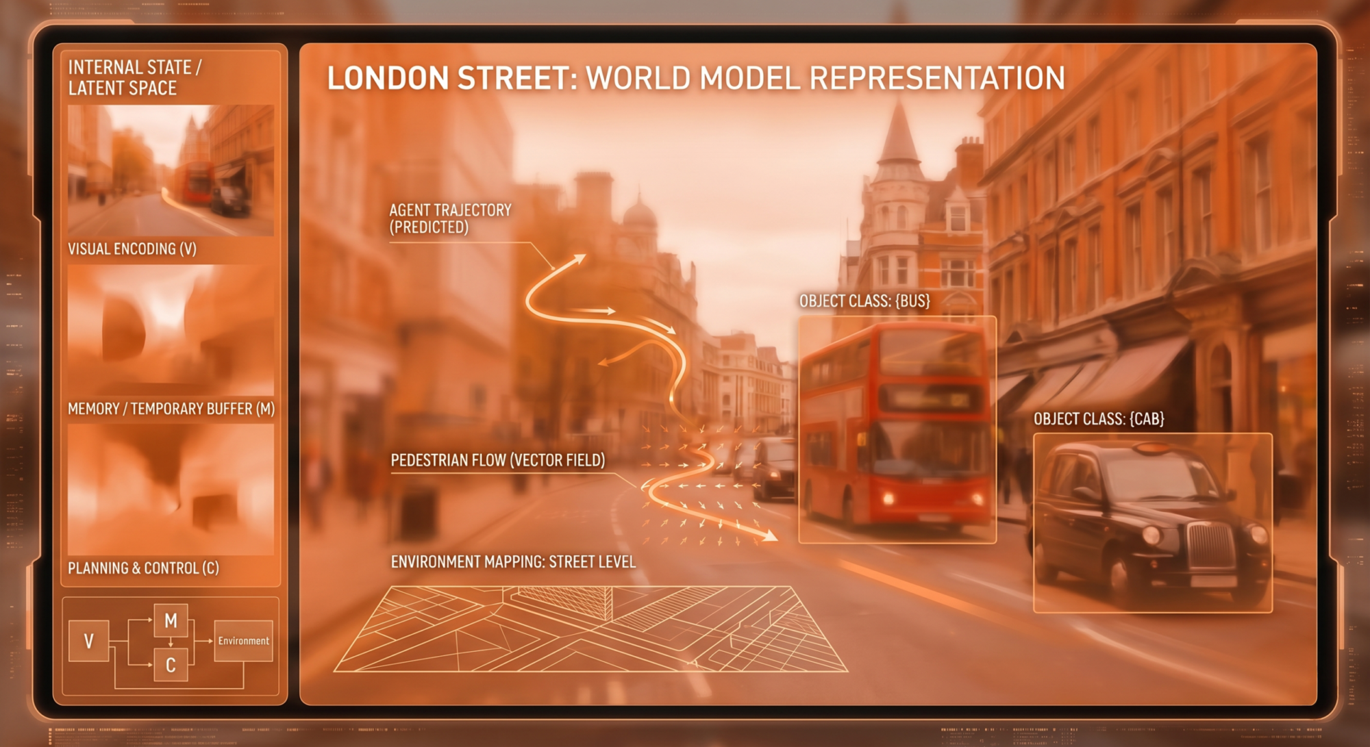
A World Model does not just query a database of street nodes; it simulates the environment itself. It operates much closer to human spatial intuition. If a human encounters a blocked street, they don’t just calculate the next mathematically viable sequence of turns; they understand the physical constraints of the neighbourhood, the flow of pedestrians, the width of the city streets, and the likely downstream effects of the blockage.
World Models aim to give AI this causal and physical understanding of the environment. Google DeepMind and World Labs are already building models that generate interactive, 3D virtual environments from simple prompts. These aren’t just pretty 3D pictures; they are physics-aware models.
For the geospatial industry, the leap from a “database of coordinates” to a “causal simulation of reality” renders traditional methodologies incredibly vulnerable. If an AI can natively understand spatial relations, cause-and-effect, and physical geometry, the old way of managing spatial data begins to look like using an abacus in the age of the microchip.
The Commoditisation of “Ground Truth”
The most immediate and existential threat will be felt by the geospatial data companies—the maintainers of the map. Firms like HERE and traditional surveying organisations like the Ordnance Survey possess immense competitive moats because they own proprietary, high-precision, heavily curated datasets. Their entire product is verified “ground truth.”
World models threaten to commoditize this ground truth by generating it synthetically and continuously. The article notes that Niantic (the creators of Pokémon Go) is utilizing billions of crowdsourced smartphone images to build the pieces of a spatial world model to guide delivery robots. This bypasses the need for traditional, centralised mapping fleets.
More radically, world models possess the ability to interpolate and probabilistically generate spatial data. If a World Model has ingested enough video data of a city’s architecture, street widths, and typical traffic patterns, it doesn’t necessarily need a fresh LIDAR scan of a specific side-street to know what is there. It can probabilistically simulate the street, complete with physics-compliant surfaces, lighting, and spatial boundaries, on the fly.
If the tech giants can generate real-time, interactive 3D simulations of any environment using a mix of text, scattered crowdsourced video, and predictive spatial intelligence, the business model of selling static, highly expensive HD maps faces an inevitable collapse. The data companies will be forced into a painful pivot: their vast historical archives will be incredibly valuable as initial training data for these models, but once the models are robust, the ongoing value of traditional, manual map updates will plummet.
They must transition from selling records of the past to facilitating predictions of the present.
The Toolmakers’ Dilemma: ESRI and the Generative Leap
While data companies face commoditisation, the software toolmakers like ESRI face the threat of obsolescence through user-interface revolution. ESRI’s ArcGIS is the undisputed heavyweight of spatial analytics. It is an indispensable tool for urban planners, environmental scientists, and logisticians.
Yet, GIS is fundamentally analytical and representational. The workflow is manual and layered: a user imports data, applies spatial joins or buffers, runs a query, and outputs a 2D or 3D visualization.
World Models represent a leap from the analytical to the generative. Instead of an emergency planner using GIS software to overlay a flood-risk polygon onto a city map to calculate affected building footprints, a World Model allows the planner to simply prompt: “Simulate a Category 4 hurricane hitting the Miami coastline at high tide, and highlight structural failures in residential zones.” The model—understanding the physics of fluid dynamics, the structural integrity of different building materials based on historical data, and the 3D topography of the city—would generate a real-time, interactive simulation of the disaster. The user isn’t joining tables or managing shapefiles; they are conversing with a physics-engine that understands geography.
If AI systems can natively execute complex spatial workflows through natural language and return interactive simulations, the traditional GIS interface becomes a bottleneck. To survive, ESRI and its competitors cannot continue with their current approach of just bolting an LLM chatbot onto their existing software. They must fundamentally rebuild their platforms, transitioning from passive repositories of spatial layers into active, world-simulating engines.
The Philosophical Chasm: The Map That Dreams
Beyond the shifting corporate landscapes and disrupted business models lies a profound philosophical dilemma. The geospatial industry has always been anchored to a sacred concept: absolute fidelity to physical reality. The map is a contract of truth. If a map says a road exists, the road must exist.
But as we transition to World Models, we enter the territory famously described by French philosopher Jean Baudrillard in Simulacra and Simulation, referencing the analogy of Borges’ Map. Baudrillard theorised a state where the simulation of reality, as illustrated by the famous short story of Borges’ Map, becomes so pervasive and detailed that it precedes and eventually obscures the real world—where the map becomes the territory.
World Models are inherently probabilistic. When a system generates a 3D environment based on a mix of real data and predictive algorithms, it is not merely recalling reality; it is hallucinating a highly plausible reality based on statistical weights.
What happens when we begin to run our physical world based on the outputs of a synthetic simulation?
If an autonomous vehicle navigates a city street using a generative world model rather than a deterministic HD map, it is navigating a probabilistic representation of that street. If the model statistically determines that a dark patch of asphalt is likely a shadow rather than a pothole, or that a newly constructed glass facade reflects open sky, the synthetic world clashes violently with the real one.
The well-documented danger of LLMs is that they confidently hallucinate facts. The impending danger of World Models is that they confidently hallucinate reality.
For a traditional cartographer, an error is a mislabeled street—a verifiable departure from ground truth that can be manually corrected. But in a World Model, the concept of ground truth is fluid. If an urban planner uses a world model to redesign a traffic intersection, and the model subtly hallucinates the turning radius of a delivery truck because its internal physics engine approximated the data, the resulting real-world concrete will be poured based on a synthetic lie.
We are moving from an era of cartography to an era of spatial generation. The cartographer meticulously measures what is; the generative AI probabilistically dreams what might be.
Navigating the Uncharted
The developments discussed by MIT Technology Review—the reallocation of OpenAI’s resources toward world simulation, the birth of World Labs, the laser focus of the industry’s brightest minds—are the latest warning sirens for the geospatial sector.
The era of the static, queried map is drawing to a close.
Legacy companies have survived massive technological shifts before, evolving from paper charts to digital databases, and from desktop software to cloud infrastructure. But the rise of the World Model is entirely different. It is not a new medium for displaying spatial data; it is a fundamental replacement for how spatial intelligence is computed.
To survive the coming decade, the geospatial industry must accept that its future does not lie solely in capturing reality with higher fidelity. The future belongs to those who can build the most robust, physics-aware, and dynamically predictive simulations of reality. They must evolve from being the archivists of the Earth to becoming the architects of its digital twin.
Yet, as we eagerly hand over the spatial mechanics of our world to generative models, we must proceed with profound caution. In our rush to build AI that truly “understands” the physical world, we run the very real risk of creating systems that replace our shared, tangible reality with a plausible, synthetic dream.